Saturday, October 13, 2018
EVE West Bengal
Our State --West Bengal
Location of West Bengal on the Map of India

West
Bengal, state of India, located in the eastern part of the country. It is
bounded to the north by the state of Sikkim and the country of Bhutan, to the northeast by the state of Assam, to the east by the country of Bangladesh, to the south by the Bay of Bengal, to the southwest by the state of Odisha, to the west by the states of Jharkhandand Bihar, and to the northwest by the country of Nepal.
. Although in area West Bengal ranks as one of
the smaller states of India, it is one of the largest in population. The
capital is Kolkata (Calcutta). Area 34,267 square miles (88,752
square km). Pop. (2011) 91,347,736.
Political Geography of West Bengal
There are 23 districts and 5 divisions in West Bengal
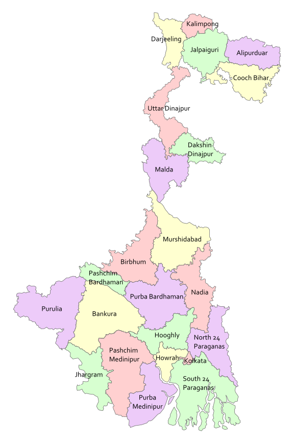
5 Division
The Burdwan Division consists of Paschim Bardhaman district, Purba Bardhaman, Birbhum, and Hooghly
The Midnapur Division consists of Purba Midnapore, Paschim Medinipur, Jhargram, Bankura and Purulia,
, The Jalpaiguri Division consists of Alipurduar, Cooch Behar, Darjeeling, Jalpaiguri, and Kalimpong,
The Presidency Division consists of Kolkata, Nadia, North 24 Parganas, South 24 Parganas and Howrah.
Subscribe to:
Comments (Atom)